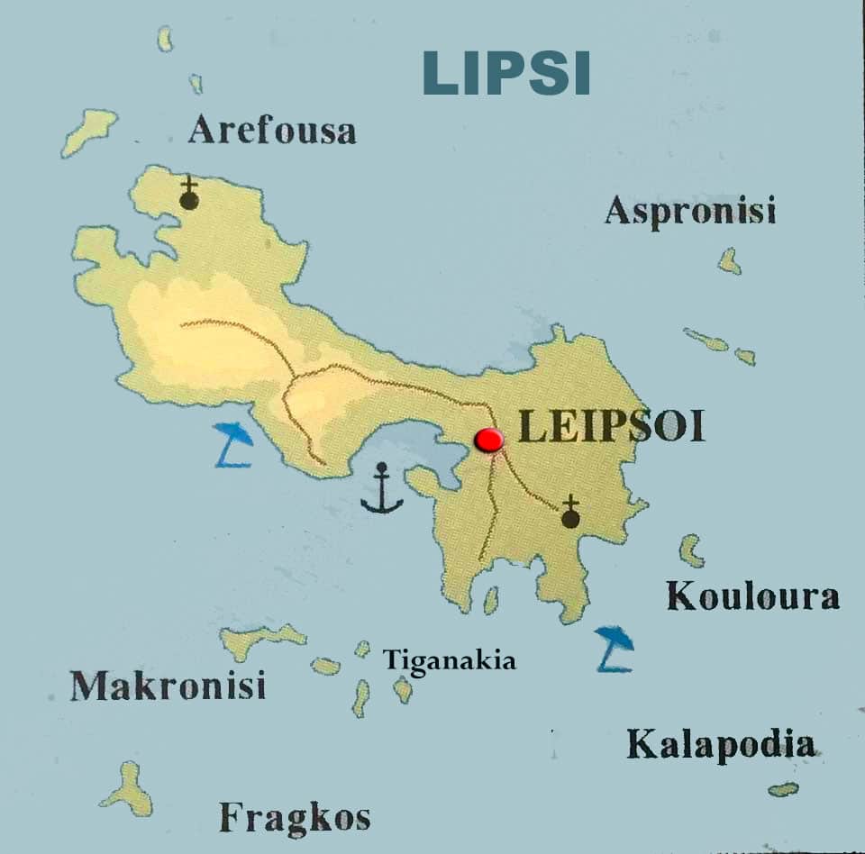
lipsi

Map of Lipsi

Lipsi is a group of 24 small islands in the Dodecanese with larger the island of Lipsos. It is located ca 173 nautical miles from Piraeus and has 790 inhabitants. Lipsos, the main island from which the name of this cluster comes, is located between Patmos to the west and Leros to the south and a little further east of the imaginary straight line that unites, in the greek islands of the Dodecanese.

Lipsi is  part of the Dodecanese prefecture in Greece. The map of Lipsi Island is a valuable guide for exploring the island, as it depicts important points of interest, beaches, hiking trails and other attractions.

The island of Lipsos, located near Patmos, is known for its calm atmosphere, crystal clear waters and beautiful landscapes. On the map of the island one can see the main villages, such as Chora, the central village of Leipsos, as well as Platys Gialos, one of the most popular beaches of the island.

The map also shows the various hiking trails that cross the island, offering amazing views of the Aegean and the surrounding islands. Many of these paths lead to secluded beaches and historical monuments such as old churches and monasteries

Location

Geographic Coordinates: Lipsi is situated approximately between 37.29° to 37.32° North latitude and 26.76° to 26.80° East longitude.

Dodecanese Islands: Lipsi is part of the Dodecanese group of islands, which is located in the southeastern Aegean Sea. It is one of the smaller islands in this archipelago.

Proximity to Turkey: Lipsi lies relatively close to the southwestern coast of Turkey, with the nearest point on the Turkish mainland being around 19 kilometers (12 miles) away.

Distance from Other Islands: Lipsi is located to the southeast of Leros, another island in the Dodecanese group, and is approximately 10 kilometers (6 miles) away from Leros.

Transportation: The island is accessible by ferry from various ports in Greece, including Piraeus (the port of Athens), Kos, and Rhodes. There are also ferry connections between Lipsi and neighboring islands like Leros.

Terrain and Size: Lipsi is a relatively small island, covering an area of approximately 16 square kilometers (6 square miles). Its terrain is characterized by rocky hills, fertile valleys, and a coastline with numerous coves and beaches.

Administrative Division: Lipsi is part of the South Aegean region of Greece and is administratively a municipality within the Kalymnos regional unit.

See the location of Lipsi on a Greek map

Lipsi map

lipsi-map
MAP OF LIPSI